
Commercial Info
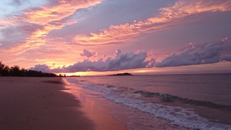
Areas near town–Wirrwawuy; Gäluru (East Woody); Gaḏalathami (Town Beach); Gumuniya (Buffalo Creek); Ḻombuy (Crocodile Creek); and Nhulun — are just outside of the town lease but part of Dhimurru’s IPA and managed as recreation areas.
The beaches and lookout on Nhulun all have easy car access on sealed roads, apart from Lombuy. There is no overnight camping allowed at these sites. A Visitor Access Permit is required to enter these areas.
Recreation Area Map
Download a map here, there is more information available on our different recreation areas including track distances and difficulty-levels, you can download our guide.
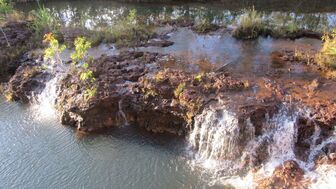
Guwatjurumurru (Giddy River)
Guwatjurumurru (Giddy River) is a river with beautiful waterholes and mini-gorges. Resistant rock has defined the shape of the river channel and forms shallow shelves between the more deeply carved sections of the watercourse.
Located approximately 40km from Nhulunbuy, the track provides access to the western side of the river. There are three camp sites for up to 15 people at each site, located along the river.
Bariŋura (Little Bondi Beach)
Bariŋura (Little Bondi Beach) lies at the northern end of the walking trail that includes the beaches of Ŋumy, Garanhan and Binydjarrŋa.
The track descends to the car park via a slope covered by open eucalypt forest that alternates near the base of the slope with coastal monsoon vine forest and vegetation characteristic of lowland freshwater streams, including paperbarks and Pandanus species. The beach is a stretch of white sand with rolling sand dunes.
This site has a composting toilet. There are five beach campsites for up to six people at each.
Ŋumuy (Turtle Beach)
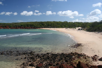
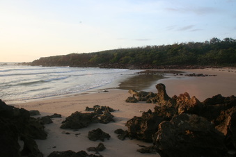
Ŋumuy (Turtle Beach) The access track winds through a patch of retja, or coastal monsoon vine forest, to the white sands of this popular beach. Track conditions are generally good, though rocky and sandy in parts, Walking tracks to Bariŋura (Little Bondi Beach) and Garanhan (Macassan Beach) form an onward walking trail.
There is a composting toilet at this site and two small camp sites the first holding up to 10 and second up to six people. Caution should be taken near the rocks as dangerous strong rips sometimes occur and crocodiles have been seen here.
Garanhan (Macassan Beach)
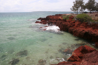
Garanhan (Macassan Beach) is a long, wide beach of white sand which contrasts with the rough-textured shelves of laterite that run parallel to the general line of the coast. A narrow, dense strip of retja (monsoon coastal vine forest) overlies the rock-shelf and a short walk behind the sandhills leads to a paperbark swamp.
There are good shady picnic and camping spots under the casuarinas behind the rockshelf. Garahnan has five campsites varying in capacity from two to 15 people at each. The maximum number of occupants can be found at online booking. There is also a composting toilet at this site.
Binydjarrŋa (Daliwuy Bay)
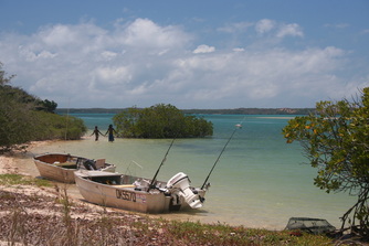
Binydjarrŋa (Daliwuy Bay) Binydjarrŋa, has a boat launching area and campsites have a view of the bay. Facilities here include composting toilets and tables. There are three campsites at this location. Sites 1 and 2 have a capacity of six with Site 3 having a capacity of up to 10 people. Good vehicle access provides opportunities to experience mangrove estuaries, mudflats, paperbark trees (Melaleuca) and other features of the inter-tidal zone.
The mangroves form a dense forest that extends over a large area of tidal mudflats and sand flats. A thin belt of coastal monsoon rainforest that grows on low sandy ridges running parallel to the shoreline merges with nearby open eucalypt forest. This area is popular for fishing. Crocodiles are often sighted here.
Baṉambarrŋa (Rainbow Cliff)
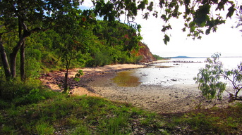
Baṉambarrŋa (Rainbow Cliff) is a sheer section of coastline where the exposed and weathered rock profile produces a striking colourful effect on the cliff face as it plunges over 40 meters into the sea. Open forest runs to the top of the cliff and a small tidal creek winds through a mangrove community to spill into the sea at its western end, where there is easy access to a sandy beach.
The top of the cliff is a Sacred Site and access is not permitted. Follow the road to the eastern side of the cliffs to see a spectacular view from the laterite shelf adjacent to the cliff base.
Latram River
The western side of the track leads to a small cliff, four campsites are located here and have sea views, Site 1 and 4 have a maximum of 10 people while sites 2 and 3 have a maximum 15. There is also a composting toilet on this site.
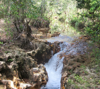
Also known as the Latram River, and incorporating Goanna Lagoon, Wathawuy is a stream that winds its way through open Eucalyptus forest. It is a pleasant and popular destination for a day or overnight trip from Nhulunbuy. The floor of the stream is generally shallow and sandy with deeper waterholes in some places. There is easy access to the water at several spots.
The Latram River side of Wathawuy has six campsites. Sites 1 to 4 have a maximum of up 15 people in each, whilst Sites 5 and 6 can hold up to six people. The Goanna Lagoon side of Wathawuy has three sites for up to 15 people camping at each. There is a composting toilet at the Latram River and Goanna Lagoon.
Recreation Area Map
Download a map here, there is more information available on our different recreation areas including track distances and difficulty-levels, you can download our guide.
Camping Only areas
Some of the Dhimurru Recreation Areas have been designated as Camping Only. Visitation to these cultural and environmentally significant sites is carefully managed. Some of these ares can be exclusively booked by one group and provide a unique exclusive camping experience. Visiting these areas is not allowed without a valid camping permit for each person, even if only visiting during the day.
Waṉuwuy (Cape Arnhem)
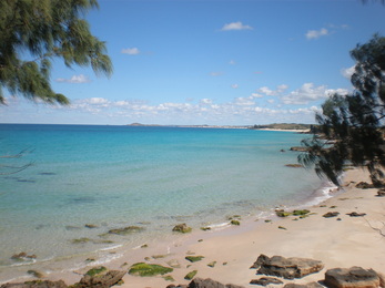
PLEASE NOTE: Closed for Turtle nesting season all of August and September. Waṉuwuy (Cape Arnhem) is characterised by broad sandy beaches and extensive dune fields bounded by unusually clear seas and mangrove-fringed tidal inlets. A dominant landscape feature of the peninsula area of Manydjarrarrnga-Waṉuwuy is the wind-formed Quaternary dune system, which rises to 60 metres in places.
Other geological formations included undifferentiated marine silts in the upper reaches of Ḏaliwuy Bay, as well as Bradshaw granite outcrops which form localised yet distinctive habitats at several locations in the dune fields, on the offshore islets, and in Ḏaliwuy Bay itself. Only camping is available at Wanuwuy. There is a twelve-vehicle maximum limit, per day. Wanuwuy has five sites. The first four sites located at the northern end provide sea views. Site 1 has a maximum capacity of 15 people with a three car limit whilst the others have a maximum capacity of 10 people (with a two car limit). Site 5, Ḻurrpukurru is located at the southern end and has a 15 person capacity with a three car limit.
Manaŋaymi (Scout Camp)
Manaŋaymi (Scout Camp) is located north of the Central Arnhem Highway. This beautiful bush setting is situated alongside a waterfall and freshwater pools in sandy open woodland. This area has five campsites available with a seven car maximum limit.
Campsites 1 to 3 have a maximum limit of six people with a one car space and the ability to accommodate a camper trailer also. Sites 4 and 5 have a 10 person limit with a two car limit at each site. This area is popular with families. There is also a composting toilet at this site.
Gaṉami, (Wonga Creek)
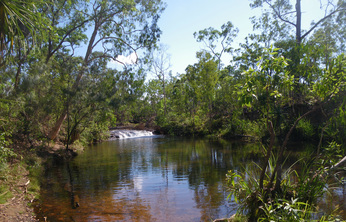
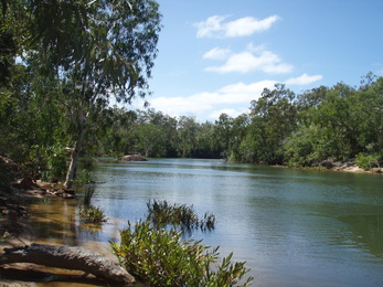
Gaṉami, (Wonga Creek) is a freshwater creek running through open Eucalypt forest. It forms a mangrove estuary at its mouth where it flows into Port Bradshaw.
The campsite is a waterhole with rock pools and flowing water all year round. It is at the upper limits of tidal influence and crocodiles inhabit the area. This is an exclusive camp site with only one group allowed to book at any one time. The site can accommodate up to 25 people with a maximum of five cars.
Gapuru, (Memorial Park),
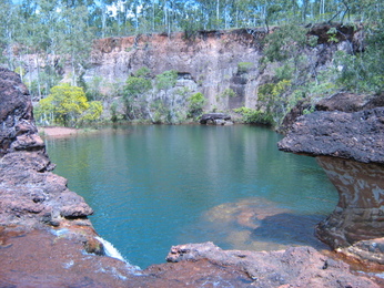
Located in the upper catchment of Ganami, Gapuru, (Memorial Park), has a campsite adjacent to numerous freshwater rockpools. This area is an exclusive booking site that is open to camping only. There is a maximum group size of 25 with a five vehicle limit.
This site has a composting toilet. Compliance with these access conditions ensures visitors enjoy the privacy they anticipate when making a booking, and the public’s support for this visitor management system is appreciated.
Recreation Area Map
Download a map here, there is more information available on our different recreation areas including track distances and difficulty-levels, you can download our guide.